How to classify this? Can we have some sort of guide to ATLAS/SWIRE please?
-
 by
JeanTate
by
JeanTate
In the center is a radio source very likely associated with the IR source also at the center. But is it a #compact? or is the radio emission sufficiently bigger than the ATLAS beam to warrant it being called a #corejet/#headtail/#hourglass?
In the NW is an extended (bigger than beamsize?) relatively faint radio source not obviously associated with particular SWIRE source. Is it reasonable to think it's a lobe associated with the central source? If not, is it bright enough to call it an #ifrs?
At the W edge is part of an #overedge source. There's no ATLAS link to click on, so no way (that I know of) to see its full extent). This is outside FIRST's footprint, but not NVSS'; however, without a scale, or any idea of relative ATLAS/NVSS sensitivity, I can't even begin to even guess if the NVSS to the W is the same as this overedge ATLAS source or not.
In addition, NVSS shows a fairly (very?) bright radio source to the SW:
Without knowing anything about the ATLAS noise pattern, I can't even guess if any/all? of the sources in ARG0003s93 are #artifacts due to this source.
Frustrating.
Posted
-
 by
WizardHowl
by
WizardHowl
I agree it is very difficult to classify and not helped by the lack of other surveys to help with follow-up (no FIRST/SDSS). It looks like there's nothing there in NVSS but that may be because the sources are too faint for it - this seems to be quite common amongst those I have classified (though with brighter sources NVSS does show something). In order to see whether or not the radio signal seen here might be an artefact or not, it would be necessary to look at larger images - larger than the radio noise pattern seen here. Without such a larger image it is also very difficult to be sure where the IR host, if any, for a particular source might be.
One of the features that helps to inform about FIRST and NVSS sources is the ability to look at those surveys from the links underneath the image and to zoom them out. If this could be done for the ATLAS images when they appear it would be very useful.
Is there any overlap between FIRST and ATLAS? Comparing some different sources (e.g. compact, hourglass, lobed and tailed sources etc.) would help everyone to understand what we're seeing in the classification images.
Perhaps it might be useful to put the beam shape for a point source in one corner of the image (as is done on the images in scientific papers)?
What do the other users and scientists think of these suggestions?
Posted
-
 by
Dolorous_Edd
by
Dolorous_Edd
Maybe this will be helpful
http://arxiv.org/abs/1405.6484
Posted
-
 by
ivywong
scientist, admin
by
ivywong
scientist, admin
Welcome to the Southern hemisphere ! Most of the current optical archives cover the Northern or the equatorial sky regions so you are spot-on with saying that it's more difficult to analyse the ATLAS sources. The Southern equivalent of SDSS is SkyMapper but the first catalogue will be published sometime later this year. Also note that even if there is optical sky coverage, ATLAS is a much deep survey than FIRST so many of the host counterparts may only be visible in the infrared at these high redshifts.
While FIRST looks at the SDSS fields in the equatorial regions, ATLAS is focussing on 2 very deep fields in the South so no, there is no overlap. The link to the project page is: http://www.atnf.csiro.au/research/deep/index.html and you can find out more from their publications.
To match the depth of ATLAS, the complementary infrared images are from the Spitzer Space Telescope and compared to WISE, Spitzer has better angular resolution.
I will ask the developers about putting the beam in a corner.
Posted
-
by
ivywong
scientist, admin
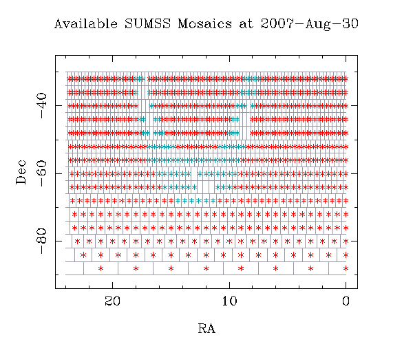
Just a follow up to my previous post, if the object is between -90 and -30 degrees declination, you may find some other radio postage stamps from the SUMSS survey: http://www.astrop.physics.usyd.edu.au/cgi-bin/postage.pl
The SUMSS coverage map is found here: http://www.astrop.physics.usyd.edu.au/images/available_mosaics.gif
Posted
-
 by
KWillett
scientist, admin, translator
by
KWillett
scientist, admin, translator
And there's a blog post covering some more details about SWIRE and ATLAS up now: http://blog.galaxyzoo.org/2015/01/22/atlas-data-and-radio-galaxy-zoo-more-details/
Posted
-
by
KWillett
scientist, admin, translator
Post might be fairly jargon-filled, now that I re-read it. Let me know if there's anything I can try to better explain!
Posted
-
by
JeanTate
Thanks Kyle.
I understand the principle of interferometry, used by both radio telescopes to build up images, but did not get this: "(filling the uv-plane)"; what is "the uv plane"?
Oh, and it took me a while to recognize "HyMORS" - Hybrid MOrphology Radio Sources, or hybrids. We talk a lot about WATs, but not HyMORS.
Posted
-
by
KWillett
scientist, admin, translator
Good question. The "uv-plane" refers to the Fourier transform of the visibility measured on the sky (radio astronomers use coordinates named u and v for this). Each point in it refers to a particular orientation and angular separation on the sky being measured by a pair of telescopes in the array. The more uv-points observed by a telescope, the more detail of an object can be observed.
If you take a really short integration of the sky from an array, each pair of telescopes corresponds to a point in the uv-plane. You can "fill" out the plane by integrating for longer times; as your source moves across the sky, its orientation with respect to each pair of telescopes will change and you'll measure a different visibility. These look like elliptical tracks in the way they're usually plotted. A perfect measurement would fill out the entire plane, but that's not practical since you'd need an infinite amount of dishes.
The VLA gets good sampling (filling of the uv-plane) even in short exposures because it has so many antennas. Since the ATCA has fewer antennas, they have to extend their sampling by taking long observations and filling the plane due to the rotation of the Earth.
Some example images from NRAO:


You can also get better uv-coverage by taking multiple observations with different configurations of the antennas. Both the VLA and ATCA physically move the antennas every few months to help with this.
HyMORs aren't commonly found, but they're very neat! I think one of the first RGZ papers will be about the new ones discovered in the project.
Posted
-
by
JeanTate
in response to KWillett's comment.
Thanks Kyle.
Posted
-
by
JeanTate
in response to JeanTate's comment.
With the help of some contour overlay images, I think I have most of my answers; how about you, WizardHowl?


In the left hand column, the background image is the ATLAS image (plus contours) from ARG0003s93, from a screenshot.
In the right hand column, the background image is a SWIRE cutout, using the SWIRE cutout service (default is JPEG, inverted).
In the top row, NVSS contours (in cyan) are overlaid.
In the bottom row, contours derived from WISE band 1 (3.4μ, magenta) are overlaid.
I think these four images - together with the ARG field (ATLAS contours on SWIRE image) - are quite informative. Let's discuss.
The images in this post were created from sources, and using methods, described in this RGZ Talk post. The image is centered at (RA, Dec) = (52.641, -27.993)
UPDATE: well, may there never be a day when you don't learn something new! Despite what my Python program writes onto the images, they're actually 400x400 pix! 😮 😮 😮 Oh the joys of quirks of programming languages! I found the problem, have fixed it, and will re-do the erroneous images (they'll look almost exactly the same; it's a scaling thing, not a truncation or anything nasty like that).
Posted
-
by
ivywong
scientist, admin
Nice progress! Keep up the good work!
Posted
-
by
JeanTate
in response to JeanTate's comment.
Thanks Ivy.
Rather than replace the, um, errant images, I will post the corrected ones separately (I'm not a fan of revisionism, and Talk makes that ridiculously easy).
NVSS contours (cyan) overlaid on ARG0003s93 ATLAS (screenshot; slider pushed to the far left):

NVSS contours (cyan) overlaid on ARG0003s93 SWIRE cutout, using the SWIRE cutout service (default is JPEG, inverted):

WISE band 1 (3.4μ, magenta) contours overlaid on ARG0003s93 ATLAS (screenshot; slider pushed to the far left):

WISE band 1 (3.4μ, magenta) contours overlaid on SWIRE cutout:

The images in this post were created from sources, and using methods, described in this RGZ Talk post. The image is centered at (RA, Dec) = (52.641, -27.993)
Posted